What Caused the Rasuwa Flood? Scientists Investigate Glacier Collapse, Ice Avalanche and Earthquake Link
The devastating flash flood that struck Nepal's Rasuwa district on Wednesday did not appear to be an ordinary monsoon flood. Instead, preliminary scientific and…
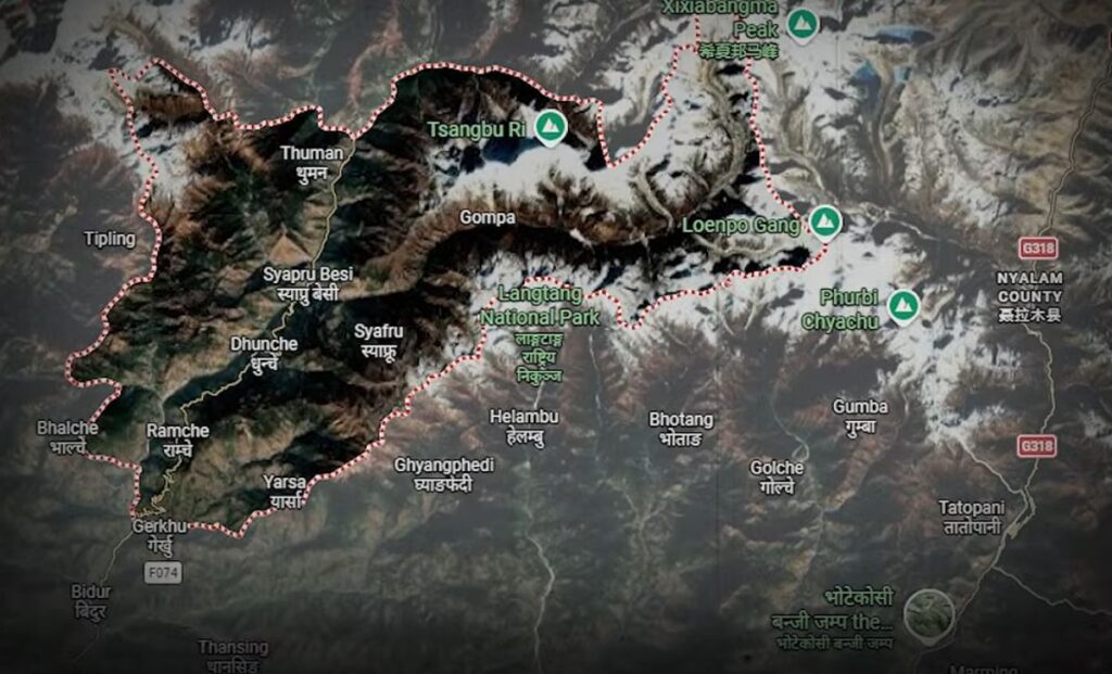
What Caused The Rasuwa Flood
The devastating flash flood that struck Nepal’s Rasuwa district on Wednesday did not appear to be an ordinary monsoon flood.
Instead, preliminary scientific and government assessments point toward a sudden high-altitude event involving ice, rock and water on the Tibet side of the Nepal-China border.
The exact chain of events is still being investigated, but authorities and scientists are increasingly focusing on an ice-and-rock avalanche or glacier collapse that may have entered the Lhende River, temporarily blocked its flow and then released a massive surge of water and debris downstream.
That surge travelled into the Bhote Koshi River, producing the destructive flood that swept through Rasuwa and continued toward Nuwakot and other downstream districts.
It was not simply heavy rainfall
One of the most important aspects of the disaster is that the initial evidence does not point to ordinary rainfall in Rasuwa as the main trigger.
The flood arrived suddenly from the Tibet side, carrying enormous quantities of water, mud, ice and rock.
That is different from a conventional monsoon flood, where prolonged rainfall gradually raises river levels.
Instead, people in the affected corridor described a sudden wall of water and debris moving downstream with little warning.
Scientists are therefore investigating what happened high in the Himalayan catchment before the flood reached Nepal.
The leading theory: an ice-and-rock avalanche
An initial assessment cited by The Kathmandu Post suggests that an avalanche may have blocked the Lhende River before triggering the sudden surge.
The Lhende River is connected to the Bhote Koshi system that flows south into Nepal.
The theory is that a large mass of ice, snow and rock suddenly collapsed from the high mountains and entered the river valley.
If the debris temporarily blocked the river, water could have accumulated behind the blockage.
Once that natural barrier failed, the stored water and debris would have been released almost instantaneously, creating a powerful flash flood.
This would explain why the flood was so sudden and why it carried such a large amount of rock and sediment downstream.
Satellite images provide important clues
Satellite imagery has provided some of the strongest evidence so far.
Analysis cited by Reuters found that a significant section of a glacier at an altitude of approximately 5,200 metres had broken away and crashed into a valley more than 1,200 metres below.
The collapse appears to have produced a huge mixture of ice, rock and debris capable of generating a sudden surge into the river system.
Nepal’s National Disaster Risk Reduction and Management Authority also reported satellite-based analysis indicating a major snow-and-rock landslide in the upper catchment.
The findings are still preliminary, but they have shifted attention away from the idea of a simple rain-driven flood.
Could an earthquake have triggered the collapse?
Another important clue emerged from earthquake monitoring.
A magnitude 4.4 earthquake was detected near the Nepal-Tibet border shortly before the disaster.
Scientists are investigating whether the earthquake destabilised the glacier or surrounding mountain slope and triggered the ice-and-rock avalanche.
Nepal’s foreign minister also told parliament that preliminary information suggested an earthquake may have triggered an avalanche that subsequently caused the flood.
However, scientists have not yet established a definitive cause-and-effect relationship.
A magnitude 4.4 earthquake does not automatically mean it caused a glacier collapse. The timing and location are important clues, but further geological analysis is required.
Another possibility: a temporary debris lake
Another emerging theory involves the formation of a temporary lake behind the avalanche debris.
The ice and rock could have blocked the Lhende River, allowing water to accumulate behind the blockage.
Such a temporary lake would not necessarily remain stable.
If the debris barrier weakened or collapsed, the stored water could have escaped suddenly, producing a destructive outburst flood.
The Kathmandu Post has reported that scientists are investigating the possibility that an ice avalanche and the subsequent formation and bursting of a debris lake triggered the Bhote Koshi flood.
This would mean the event was not simply an avalanche or simply a flood, but a chain reaction:
Mountain collapse → river blockage → water accumulation → sudden release → flash flood → downstream destruction
What about a glacial lake outburst flood?
A Glacial Lake Outburst Flood, or GLOF, is also being considered.
A GLOF occurs when water stored in or near a glacier is suddenly released, often after the failure of a natural ice, rock or sediment dam.
The Himalayan region contains numerous glacial lakes, and some can become dangerous when their natural barriers become unstable.
Early reports initially focused heavily on the possibility of a GLOF in Tibet.
However, the latest satellite and geological assessments increasingly point toward an ice-rock avalanche and possible debris blockage as the immediate mechanism.
Scientists are still determining whether a pre-existing glacial lake was involved or whether the water surge was generated primarily by the avalanche itself.
Why the flood became so destructive
The nature of the suspected trigger helps explain the extraordinary force of the flood.
An ordinary river flood mainly transports water.
This event appears to have carried a massive mixture of:
- Water
- Ice
- Snow
- Large rocks
- Mud
- Mountain debris
- Trees and other material
That mixture behaves differently from normal floodwater.
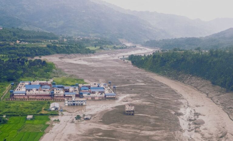
Heavy rocks and debris can smash bridges, destroy buildings and block roads while the water continues moving downstream.
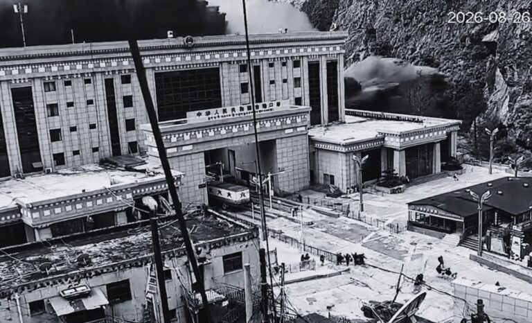
The resulting surge devastated sections of Timure, Rasuwagadhi and other communities along the Bhote Koshi corridor.
The flood moved rapidly downstream
Once the surge entered the Bhote Koshi system, the narrow Himalayan valleys provided a natural channel for the water and debris to travel downstream.
The flood then affected areas farther south, including parts of Nuwakot and Dhading.
Water levels in sections of the Trishuli system rose rapidly, while roads, bridges and riverside infrastructure were damaged.
The sudden rise left people in some locations with very little time to react.
Could climate change have played a role?
Climate change is an important part of the broader scientific discussion, but it should not be confused with the immediate trigger.
Scientists studying the disaster have pointed to the vulnerability of Himalayan glaciers and high-altitude slopes as temperatures rise.
Reuters reported that experts are examining whether recent warming and accelerated snow and ice melt may have contributed to instability in the glacier system.
Warmer conditions can weaken ice and permafrost and increase the amount of meltwater available in high-altitude environments.
But that does not mean climate change has been proven to have directly caused this particular flood.
The immediate trigger remains under investigation.
Scientists are still trying to reconstruct what happened
The biggest challenge is that the suspected trigger occurred in an extremely remote and high-altitude region.
Direct observations of the collapse are limited.
Researchers are therefore combining:
- Satellite imagery
- Earthquake records
- Geological observations
- River and flood measurements
- Drone imagery
- Local eyewitness accounts
- Damage patterns downstream
By comparing these sources, scientists can reconstruct the sequence of events.
That work is particularly important because identifying the trigger could help determine whether another similar event remains possible.
Authorities are watching for another possible blockage
The danger may not have ended with the first flood.
Experts have warned that debris may still be blocking parts of the upstream river system.
If another natural blockage fails suddenly, it could produce another flood surge.
That is one reason authorities have urged people living along the Bhote Koshi and Trishuli river corridors to remain alert and move away from dangerous riverbanks where necessary.
What is known — and what is not
At this stage, the evidence can be divided into confirmed observations and theories still under investigation.
What scientists have strong evidence for
A sudden flash flood entered Nepal from the Tibet side.
Satellite imagery shows a major ice-and-rock collapse in the high mountains.
A large quantity of rock, ice and debris entered the river system.
The resulting surge travelled through the Bhote Koshi and caused catastrophic downstream flooding.
What remains under investigation
Scientists are still determining:
- Whether the glacier collapse was directly triggered by the 4.4 earthquake
- Whether an avalanche temporarily blocked the Lhende River
- Whether a temporary debris lake formed
- Whether a pre-existing glacial lake was involved
- How much rainfall or snowmelt contributed
- Whether climate-related warming increased the instability of the glacier or surrounding terrain
The current picture
The emerging explanation is therefore not simply “heavy rain caused the Rasuwa flood.”
The evidence increasingly suggests a much more sudden Himalayan chain reaction.
A collapse of ice and rock high in the mountains may have entered the Lhende River, potentially blocking its flow. Water then accumulated and was suddenly released, sending a powerful mixture of water, ice, rock and mud into the Bhote Koshi River.
An earthquake detected shortly beforehand may have helped trigger the collapse, but that link has not yet been conclusively established.
Scientists will need further satellite analysis and field investigations to determine exactly how the disaster unfolded.
For now, the Rasuwa flood appears to have been the result of a rare and extremely powerful high-altitude event rather than a conventional rainfall-driven flood.
This remains a developing scientific investigation, and the explanation may be revised as authorities and researchers obtain more evidence.

Replies
No replies yet. Log in to be the first to reply!