
Did Human Activity in Tibet Make the Rasuwa Flood Worse? What We Know So Far
Scientists have explicitly indicated that construction and climate change are factors worth examining.
Published August 27, 2026 12:01 am GMT+0545
The Rasuwa flood has raised a question that goes beyond the immediate search for survivors: could human activity in the high Himalayas have made an already dangerous natural event more destructive?
The answer, at least for now, is not clear.
There is no evidence that China deliberately caused the disaster or that a Chinese dam was opened and released a wall of water into Nepal. The leading scientific explanation is instead that a massive ice-and-rock collapse or avalanche triggered a sudden surge in the Lhende River, possibly after a temporary blockage formed and failed. A magnitude-4.4 earthquake recorded in the region around the same time is also being investigated as a possible trigger.
But scientists are also asking whether development and human changes to the Himalayan environment could have influenced the severity of the event.
That is a different question and one that has not yet been answered.
The disaster began high in the Himalayas
The flood that devastated Rasuwa was not a conventional monsoon flood.
The Bhote Koshi suddenly surged after an event occurred in the high mountain region near the Nepal-China border.
Preliminary satellite analysis indicates that a major mass of ice and rock collapsed into the river system. Nepalese officials said debris blocked the Lhende River roughly 20 kilometres upstream from the Miteri Bridge, apparently forming a temporary lake before the blockage gave way and released a powerful surge downstream.
The resulting flood swept through Timure and Rasuwagadhi before continuing downstream into the Trishuli system.
Roads, bridges, homes, hydropower facilities and border infrastructure were destroyed or badly damaged.
So where does human activity enter the picture?
The key question is not whether a road, hydropower project or other piece of infrastructure directly "caused" the flood.
There is currently no evidence establishing that.
Instead, researchers are asking whether human activity may have altered an already unstable mountain environment or increased the amount of infrastructure exposed to a sudden natural hazard.
The Himalayan landscape around the Nepal-China border has undergone significant infrastructure development, including roads, hydropower projects and border facilities.
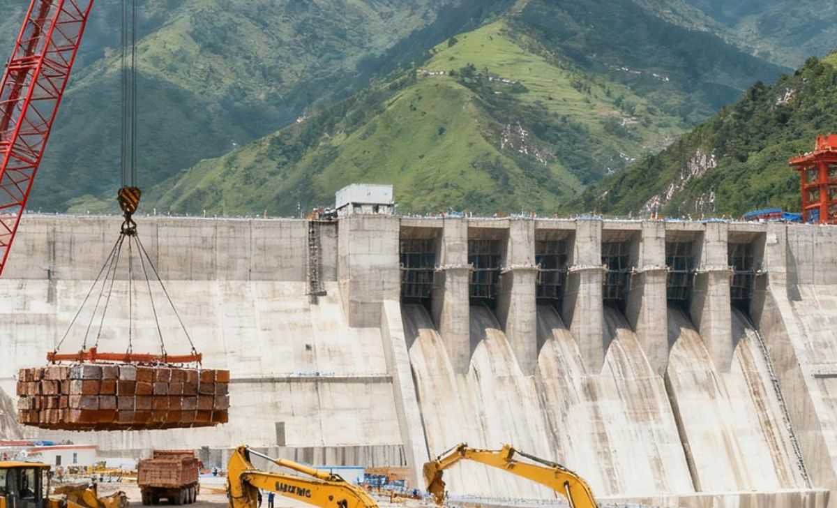
Several hydropower projects are located along the river corridors that were affected by the flood.
Reuters cited glaciologist Scott Shugar as saying construction could be a factor worth examining, while stressing that the role of climate change also needs further investigation.
That does not establish that construction caused Wednesday's collapse.
It means scientists believe the possibility deserves investigation.
The immediate trigger appears to be natural
The strongest evidence so far points toward an ice-and-rock avalanche or glacier collapse.
Researchers examining satellite imagery found evidence that part of a glacier at roughly 5,200 metres broke away and fell about 1,200 metres into a valley.
That enormous collapse could have dumped ice and rock into the river, creating the conditions for the sudden flood.
Nepal's Department of Hydrology and Meteorology has also been examining the possibility that an ice avalanche blocked the Lhende River and created a temporary debris lake.
When the blockage failed, the accumulated water would have been released rapidly.
The result would have been something far more destructive than an ordinary rise in river levels.
An earthquake may have helped trigger the collapse
Another piece of the puzzle is an earthquake detected shortly before the flood.
The US Geological Survey recorded a magnitude-4.4 earthquake in Tibetan territory at about 8:37 a.m., according to researchers cited by The Kathmandu Post.
Scientists are investigating whether the earthquake destabilised the glacier or surrounding mountain slope.
But there is an important caveat.
The earthquake's occurrence does not prove it caused the avalanche.
Researchers still need to determine whether the timing, location and energy of the earthquake were sufficient to trigger the collapse.
In other words, the current chain of events could be:
Earthquake → ice/rock collapse → river blockage → sudden release → flash flood
But that sequence remains a working hypothesis rather than a final scientific conclusion.
Could construction have weakened the landscape?
This is one of the most difficult questions to answer.
Mountain construction can involve road cutting, blasting, excavation, tunnels and other activities that alter slopes and drainage patterns.
In an extremely steep and geologically active environment, even relatively small changes can potentially affect local stability.
But there is currently no publicly available evidence showing that a specific Chinese construction project destabilised the glacier or slope that collapsed.
That distinction matters.
It would be irresponsible to turn a question about possible environmental influence into a claim of direct causation without geological evidence.
The appropriate question is therefore:
Did any human activity occur close enough to the failed slope, glacier or river system to have influenced its stability?
That is something investigators can test through satellite imagery, geological surveys and records of construction activity.
The bigger issue may be infrastructure exposure
Even if human activity had absolutely nothing to do with triggering the collapse, development may still have influenced the scale of the disaster.
The Rasuwa corridor contains settlements, roads, bridges, hydropower plants and border infrastructure close to the river.
When a sudden debris-filled flood enters such a developed valley, there is simply more infrastructure for the water to destroy.
The disaster damaged multiple hydropower projects and caused widespread disruption to electricity generation and transmission.
Road connections to the Chinese border were also badly damaged.
This creates an important distinction:
Human activity may not have caused the hazard, but human development can determine how much is at risk when the hazard arrives.
Rasuwa had already experienced a similar disaster
Wednesday's flood is also not completely without precedent.
A major Bhote Koshi flood struck the same general area in July 2025.
The previous disaster was linked by Nepal's Department of Hydrology and Meteorology to a glacial lake outburst in the upper Lhende River catchment. It destroyed the Friendship Bridge and damaged hydropower and other infrastructure.
That history makes the current disaster particularly significant.
It suggests that communities and infrastructure along the river corridor are exposed to a recurring high-altitude hazard.
The question is no longer simply whether such an event can happen.
It has happened repeatedly.
What about China's infrastructure?
The Nepal-China border region has become increasingly important for trade, transportation and energy development.
The Rasuwagadhi corridor connects Nepal with Tibet, while hydropower projects have been developed along river systems in the mountainous region.
But the presence of Chinese-linked infrastructure does not itself establish responsibility for a natural disaster.
In fact, the flood also caused serious damage on the Chinese side.
The Gyirong border area was hit by a major mudslide, with roads, communications and power infrastructure disrupted. Chinese authorities also launched their own large-scale rescue operation.
That makes a simple narrative of "China caused Nepal's flood" particularly difficult to support with the evidence currently available.
Both sides of the border were exposed to the same unstable Himalayan environment.
Climate change adds another layer
There is another form of human influence that scientists are examining: climate change.
The Himalayas are warming, and glaciers are undergoing significant changes.
Changes in glacier mass, ice stability, permafrost and meltwater can affect the likelihood of landslides, avalanches and glacial-lake outburst floods.
Scientists have already linked the broader Himalayan region's increasing hazard exposure to a changing climate.
But climate change should not be used as a shortcut explanation for every individual disaster.
Researchers still need to establish whether warming contributed to the specific glacier collapse that preceded the Rasuwa flood.
Could human activity have made the flood bigger?
There are several possible mechanisms researchers could investigate.
1. Slope disturbance
Road construction, excavation or blasting can change the stability of mountain slopes.
If such activity occurred near the eventual failure zone, investigators could examine whether it altered the local geology.
2. Changes to drainage
Infrastructure can change how water moves through a landscape.
Drainage channels, roads and construction sites can redirect water and sediment, although there is currently no evidence that this happened at the specific location responsible for Wednesday's flood.
3. Development close to rivers
Even without changing the trigger, building settlements, roads and hydropower plants close to rivers increases exposure.
That may have dramatically increased the economic and human consequences of the flood.
4. Glacier and climate effects
Human-driven warming can influence glacier stability over longer periods.
Researchers will need to determine whether the glacier involved had been experiencing unusual retreat, cracking or other changes before its collapse.
What investigators need to find out
Several questions could eventually provide a clearer answer:
Was there construction near the failure point?
Satellite images and engineering records could establish what infrastructure existed around the affected glacier and river.
Did construction change the slope?
Geological analysis could determine whether excavation or other activity contributed to instability.
Was the earthquake the trigger?
Seismic and satellite data can help determine whether the earthquake was capable of initiating the collapse.
How large was the ice-rock collapse?
Comparing before-and-after satellite imagery can reveal the volume of material that entered the river.
Was a temporary lake formed?
Researchers need to determine how much water accumulated behind the debris blockage before it failed.
Did climate-related glacier changes contribute?
Long-term satellite records can show whether the glacier had been retreating or becoming unstable.
What we know and what we don't
What we know
A sudden and exceptionally powerful flood entered the Bhote Koshi system.
Preliminary evidence points to an ice-and-rock avalanche or glacier collapse.
A temporary blockage of the Lhende River may have formed before failing.
A magnitude-4.4 earthquake occurred in the region shortly beforehand.
The flood destroyed extensive infrastructure in Nepal.
A similar glacial-related flood affected the same river corridor in 2025.
What we don't know
It has not been established that Chinese infrastructure caused the collapse.
It has not been established that construction activity triggered the flood.
It has not been established that the earthquake caused the avalanche.
It has not yet been established exactly how climate change affected the event.
And the full extent of human influence on the surrounding mountain environment remains unknown.
The question is bigger than China
It may be tempting to frame the disaster entirely around China's role because the flood originated near the Tibet border.
But the underlying problem extends across the Himalayas.
Nepal, China, India and other countries are building roads, hydropower projects, settlements and other infrastructure in one of the world's most geologically fragile environments.
The Rasuwa disaster raises a difficult question for all of them:
How much development is safe in a landscape where a glacier collapse several kilometres upstream can destroy an entire river corridor within minutes?
That question will become increasingly important as Himalayan infrastructure expands and climate conditions change.
For now, the evidence points to nature — with human influence still an open question
The evidence currently available does not support the claim that China caused the Rasuwa flood.
The immediate trigger appears to have been a powerful natural mountain event involving ice, rock and water.
But scientists have explicitly indicated that construction and climate change are factors worth examining.
That investigation matters because there is a major difference between causing a disaster and making a landscape more vulnerable to one.
The Rasuwa flood may ultimately prove to be entirely natural in its trigger.
Or investigators may discover that environmental changes, development or other human factors contributed to the instability.
Until that evidence emerges, the most accurate conclusion is also the most uncomfortable:
Nature appears to have triggered the Rasuwa catastrophe. Whether human activity made it worse remains an unanswered question.